Planning our cities better to make our houses cooler
Depleting green cover and a number of high rises have transformed cities into Urban Heat Islands. The report looks into mitigations strategies, as Bengaluru city in focus.
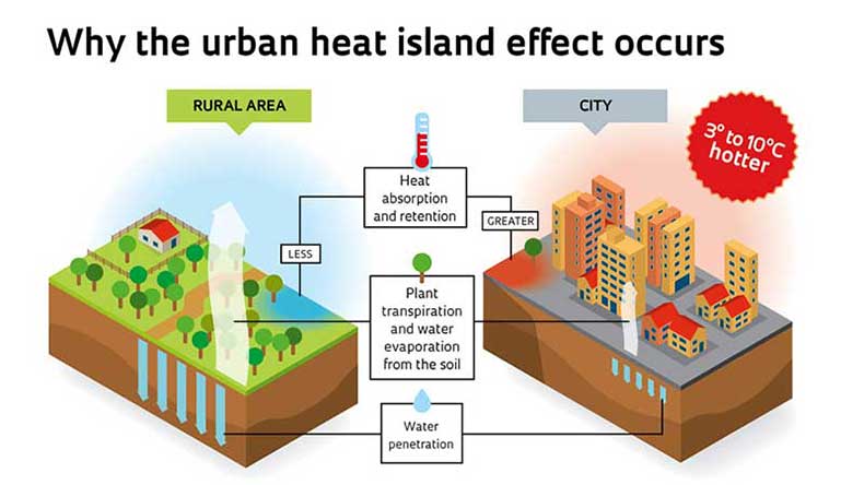
High-density development has covered urban areas with surfaces that lower their capacity to emit heat instantly. Thus, they tend to observe higher temperatures, in turn acting as "heat islands", compared to their rural counterpart.
In a study carried out by TERI in 2014, it was found that Bangalore is one such example of a city where dense urban pockets were found to be about 2°C warmer than nearby rural area. In another study done by IISC, an increase of 2-2.5°C was observed during the last decade owing to 76% decline in vegetation cover and 79% decline in water bodies, which is indisputably due to reckless urban sprawl.
Urban Heat Islands (UHI) can cause deterioration of living environment, elevation of ground level ozone, health disorders and increase in building energy consumptions. Thus the aim of the project includes assessing the impact of urban planning aspects of urban geometry and green cover on the formation of UHI within different zones of Bangalore. The study therefore helped in developing relationship between planning characters and microclimatic influence which will be useful for urban planners to mitigate UHI in newly developing areas of the city.